Bringing the Ocean to Society
The European Atlas of the Seas provides information about Europe’s marine environment. Users can view predefined and ready to use maps, covering topics such as nature, tourism, security, energy, passenger transport, sea bottom, fishing stocks and quotas, aquaculture, and much more.
Users can also benefit from an enriched catalogue with more than 200 map layers, covering a wide range of topics, to explore, collate and create their own maps. These maps can be printed, shared and embedded in articles or presentations. The Atlas is the ideal tool for schools, researchers and professionals, or anyone wishing to know more about the European seas and its coastal areas.
Map of the week powered by EurOcean
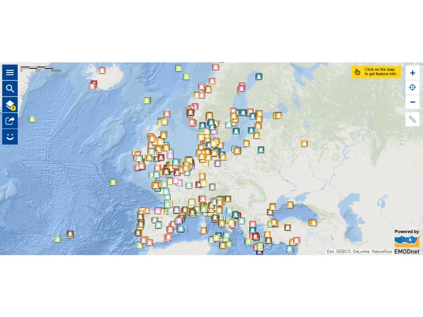
Each week, a new “Map of the Week” highlighting an interesting map layer is showcased on the Maritime Forum. The map of this week features the locations of the infrastructures listed in our RID, Europe's most complete catalogue on marine research infrastructures.